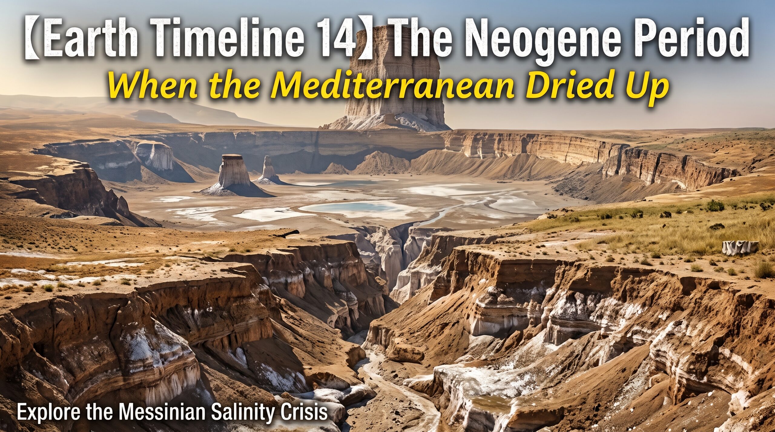
The Neogene is the second period of the Cenozoic Era, running from about 23.03 million to about 2.58 million years ago. It divides into the Miocene in the first half (23.03 to 5.33 million years ago) and the Pliocene in the second (5.33 to 2.58 million years ago). Behind it lies the Paleogene, when mammals filled the seats left empty; ahead of it waits the Quaternary, with its alternating glacials and interglacials.
The arrangement of the continents settled into roughly its present shape during this period. India had already collided with Asia and was pushing up the Himalaya; Africa and Eurasia drew close and pulled apart again and again; and the Japanese archipelago was cut loose from the edge of the continent as the Sea of Japan opened. As a globe, it looks fairly close to today.
With one exception: the Mediterranean. Near the end of this period, the Mediterranean very nearly dried out. The evidence is still there, buried beneath the seafloor — a layer of salt more than two kilometers thick in places.
Forests give way to grasslands
Early in the Miocene, the Earth was warmer than it is now. The interval from 16.9 to 14.7 million years ago is called the Miocene Climatic Optimum, with global mean temperatures estimated at 3 to 4 degrees above the present.
Then, between 14.7 and 13.8 million years ago, the trend reversed. A large ice sheet took hold on Antarctica, deep-ocean bottom temperatures fell, and the world grew cooler and drier. From that point on, the Neogene is a period of gradual, continuing cooling.
As temperatures fell and dry land expanded, the forests retreated. What moved into the vacated ground was grass.

There is a complication here. “Grasslands spread” does not mean today’s savanna simply appeared. Grasses come in two types according to how they photosynthesize, and the C4 type — the one tolerant of heat and drought — became dominant worldwide surprisingly late. Tracing carbon isotope ratios in soil carbonates puts the main C4 expansion between 8 and 3 million years ago.
In the Siwalik Group of Pakistan the switch happens abruptly, around 7.4 to 7.0 million years ago. The same shift shows up in South America, North America and East Africa, but the timing differs slightly from region to region. A global change, yet not a synchronized one.
Teeth built to grind tough grass
Eating grass is harder work than it looks. Grasses accumulate phytoliths — tiny glassy particles — inside their tissues. Made of silica, the same stuff as glass, they wear the teeth down with every bite. And animals cropping close to the ground take in soil and sand along with the meal.
The countermeasure grazers arrived at was taller teeth. Lengthen the crown — the part standing above the gum — so there is material in reserve to wear away. This is called hypsodonty, or high-crowned teeth. Horses shifted rapidly from low crowns to high ones between 20 and 10 million years ago.

But the dental change and the spread of grasslands do not line up neatly. North American horses already had high-crowned teeth before C4 grasslands expanded, and carbon isotopes preserved in their enamel show they were eating a mixture of C3 grasses and tree leaves. The teeth changed first. One view now gaining ground is that swallowing grit — soil and volcanic ash — mattered more for tooth wear than the grass itself.
The cast on land and at sea
The land of this period held beasts built along lines you will not find in any zoo today.
Deinotherium was an elephant relative whose tusks grew not from the upper jaw but downward and curving from the lower. Whether they were used to hook branches or to strip bark is still unsettled. Chalicotherium, a herbivore related to horses and rhinos, carried long claws on its forefeet and walked on its knuckles to keep those claws off the ground. Hipparion, a three-toed horse, spread across the Old World in the later Miocene and became a signature grazer of dry country.

At sea, Otodus megalodon sat at the top. Estimated at around 15 meters long, this enormous shark ranged through nearly every ocean across the Miocene. In 2019, Robert Boessenecker of the College of Charleston and colleagues re-examined the fossil record of the eastern North Pacific occurrence by occurrence and found that reliable records stop at about 3.6 million years ago. Specimens claimed to be younger either had questionable locality data or had been reworked out of older strata.
Japan has its own emblematic animal from this period: Desmostylus. A semi-aquatic mammal that lived along the shores of the North Pacific from about 18 to 13 million years ago, it had a stocky, hippo-like build. Reconstructions vary, but estimates put it at 2 to 3 meters long and 200 to 300 kilograms. The name comes from the shape of its molars: cylindrical columns bundled together to form a single tooth, a design found in no living mammal, and the Greek for “bundled pillars” became the genus name outright. The first skull ever described came from Mizunami in Gifu Prefecture; a complete skeleton was later found on Sakhalin.

The time of Desmostylus overlaps with the period when the Japanese archipelago pulled away from the mainland. The continental margin began to rift roughly 20 million years ago; northeast Japan rotated counterclockwise and southwest Japan clockwise as the gap opened, and the spreading of the Sea of Japan stopped around 15 million years ago. The structural skeleton of Japan’s present geography was laid down in this period.
And there is one more thing: this was the age of the apes. Proconsul and Ekembo from Kenya date to 20 to 17 million years ago, and Danuvius guggenmosi from southern Germany to 11.62 million years ago. Danuvius preserves clues to a posture with hips and knees extended, and it has been suggested that it walked upright on its hind legs along branches. The human and chimpanzee lineages split around 6 to 8 million years ago, and Sahelanthropus, found in Chad, dates to about 7 million years. The starting point of the human story also lies inside this period.
Gypsum out of deep-sea mud
Now to the Mediterranean.
From August to October 1970, on Leg 13 of the Deep Sea Drilling Project, the drillship Glomar Challenger bored into the floor of the Mediterranean. Aboard were Kenneth Hsü, William Ryan and Maria Bianca Cita, among others. What came up inside the recovered sediment cores was gypsum and rock salt.

Both gypsum and halite precipitate when seawater evaporates and concentrates. On the bed of a shallow salt lake they would be unremarkable. But this was the deep seafloor, thousands of meters down.
The answer the three published in Nature in 1973 was simple: at the end of the Miocene, the Mediterranean dried up. The floor of a deep basin had been exposed to the air, and the brine left behind boiled down and gave up its salt. Without picturing a scene like that, the sequence of minerals cannot be explained.
The pushback was fierce. A deep sea cannot dry out; they had spun an outrageous story from a handful of samples. Yet onshore strata around the Mediterranean, buried valleys and seismic reflection surveys kept falling into place, and the episode is now in the geology textbooks as the Messinian salinity crisis.
A drying that came in three stages
The dates have been narrowed to roughly 640,000 years, from 5.97 to 5.33 million years ago. Given that the Neogene itself lasted more than 20 million years, that is about 3 percent of it.
It unfolded in three stages. In the first, from 5.97 to 5.6 million years ago, gypsum precipitated in shallow basins around the margins. In the second, from 5.6 to 5.55 million years ago, halite piled up rapidly on the floors of the deep basins — more than two kilometers thick, the deposit known as the Mediterranean salt giant. In the third, from 5.55 to 5.33 million years ago, salinity fell instead. Large volumes of low-salinity water poured in from surrounding rivers and from the Paratethys Sea to the north, producing the brackish “Lago Mare” (lake-sea) state, whose fossils record organisms adapted to brackish water.
When the water level dropped, the rivers around the basin began falling toward a far lower base level and cut valleys with tremendous force. Around Cairo, the Nile carved a canyon reaching about 1,500 meters below the present land surface. That valley is now completely buried under the sediments of the Nile Delta. The same thing happened to the Rhône.

For living things, it was 640,000 years with nowhere to go. In 2024, a team of 29 researchers from 25 institutions led by Konstantina Agiadi of the University of Vienna compiled onshore fossils and deep-sea sediment cores from around the Mediterranean spanning 12 to 3.6 million years ago, and published the results in Science. Before the crisis, 2,006 marine species are recorded from the Mediterranean, of which 779 were endemic. Eighty-six endemic species survived the crisis — about 11 percent.
About 67 percent of the species composition turned over across the crisis. Most of that turnover came not from survivors but from newcomers arriving afterward from the Atlantic side. Diversity took more than 1.7 million years to return to its former level. The team concluded that the present decline in Mediterranean biological richness from west to east is itself an arrangement that formed after this event.
A sea that returned in two years
At 5.33 million years ago, Atlantic water broke through Gibraltar and came back. The event is known as the Zanclean flood.
In 2009, Daniel Garcia-Castellanos of the Spanish National Research Council (CSIC) in Barcelona and colleagues focused on an incision roughly 200 kilometers long running across the Strait of Gibraltar, gouged more than 250 meters deep in places. Treating it as the track of water cutting through rock and running the numbers produced figures that are hard to picture.
Peak discharge of 100 million cubic meters per second — about a thousand times the average flow of the Amazon. The Mediterranean water level may have risen more than 10 meters a day. And 90 percent of the required water moved in a span of a few months to two years.
This number needs care. It does not mean the basin filled two years after the first drop. There may have been an earlier stage of modest inflow lasting thousands of years; the two years counts from the point where self-amplification took hold — water cutting rock, the widened channel carrying yet more water.

In 2024, separate evidence for the flood turned up on land. Aaron Micallef of the Monterey Bay Aquarium Research Institute and colleagues reported in Communications Earth & Environment on more than 300 asymmetric ridges in southeastern Sicily. All are streamlined in the same direction, with chaotically mixed breccia between them, and beyond lies a 20-kilometer-wide valley leading to the Noto Canyon on the seafloor. The interpretation is that water filling the western basin overflowed through a shallow marine corridor southeast of Sicily and cascaded into the eastern basin.
The salt that did not come back
The water returned. The salt did not.
Seismic surveys put the total volume of halite stacked on the seafloor at 820,000 to 930,000 cubic kilometers; including the sediments deposited alongside it, up to 1.2 million cubic kilometers. In the deep basins it averages about 1.5 kilometers thick, and it is still lying there on the Mediterranean floor today.
That volume is, in fact, what determines the character of the whole event.
Suppose you took the Mediterranean, brim-full of seawater, and evaporated the whole thing at once. It would not come close to building this mountain of salt. By the same estimates, the Atlantic seawater required to accumulate it amounts to roughly seven or eight Mediterraneans. The water inside the basin could never have produced that quantity. Seawater must have kept entering through the narrowed passage at Gibraltar, evaporating and leaving its salt behind — over and over, or continuously.

Put another way, the salt on the floor of the Mediterranean did not come out of the Mediterranean. It was extracted from the world ocean.
That amount corresponds to roughly 5 to 6 percent of all the salt dissolved in the oceans today. A 2024 review in Nature Reviews Earth & Environment by Wout Krijgsman of Utrecht University and colleagues, summarizing the whole event, estimates that 7 to 10 percent of the total ions were removed from the ocean. The composition table of Earth’s seawater was rewritten over 640,000 years.
And it was not only sodium and chlorine that were withdrawn. Gypsum is calcium sulfate, so precipitating it carries calcium ions away as well. Less calcium in the ocean means less calcium carbonate buried on the seafloor. The bicarbonate left unfixed as carbonate tilts the water slightly toward alkalinity. A more alkaline ocean absorbs carbon dioxide from the atmosphere more readily. Less atmospheric carbon dioxide means a cooler planet.
The drop in salinity itself also has an effect. Salt water must be colder than fresh water before it freezes. Lower the salinity of the whole ocean and the freezing point rises accordingly. The idea that sea ice would then form more readily in northern waters, helping push Northern Hemisphere cooling along, has been on the table since the 1970s and is still under examination.
In short, the drying of the Mediterranean was not a Mediterranean affair. The salinity and calcium content of the world ocean changed, and so did atmospheric carbon dioxide and the temperature at which the sea freezes. A drought in one inland sea ended up on the driving side of global climate. Krijgsman and colleagues close their review by noting that salt giants can act as climate drivers altering ocean chemistry on million-year timescales, yet are still not adequately built into long-term carbon cycle models.
The questions still open
For an event this famous, a surprising amount of the detail remains unsettled.
First, how far did the water level actually fall? The standard account for fifty years was a drop of more than two kilometers, leaving the basin all but dry. But in 2022, Zohar Gvirtzman of the Geological Survey of Israel and colleagues reconstructed the shape of the buried Nile canyon after subtracting the flexure caused by the weight of later sediment and the effects of compaction. Their answer: a fall of about 600 meters — one-half to one-quarter of the conventional estimate. If that reading is right, the salt precipitated beneath one to three kilometers of water, and the picture of a nearly desiccated basin no longer holds.
Meanwhile, a 3D seismic reflection survey south of Cairo published in 2026 identified a valley nine kilometers wide, cut into hard limestone down to 1,700 to 1,800 meters below present sea level — a result supporting a deep drawdown. The same Nile, the same canyon, and the answers diverge.
Where the 86 species survived is also unknown. Were there tolerable pockets within the brine? Did they retreat toward the narrow corridor to the Atlantic? Did they shelter at marginal sites fed by fresh water? Several candidates have been proposed, but the fossil record is too coarse to decide.
How much the extracted salt moved the climate has not been pinned to numbers either. How long did it take for weathering to restore calcium to the ocean after the drawdown? Gypsum precipitation stopped and restarted repeatedly, and the ocean’s response must have shifted each time.
The Mediterranean today is a sea that loses more water to evaporation than it gains from rivers and rain. The only thing making up the difference is Atlantic water flowing in continuously through the Strait of Gibraltar. Whether that single narrow mouth stays open decides whether the basin is an ordinary sea or a plain of salt. What happened six million years ago was simply that the mouth grew narrow. The salt on the Mediterranean floor remains a target of drilling and seismic surveying to this day.
Sources
Krijgsman, W. et al. (2024) Causes and consequences of the Messinian salinity crisis. Nature Reviews Earth & Environment 5, 335–350. https://www.nature.com/articles/s43017-024-00533-1
Hsü, K. J., Ryan, W. B. F. & Cita, M. B. (1973) Late Miocene desiccation of the Mediterranean. Nature 242, 240–244. https://doi.org/10.1038/242240a0
Agiadi, K. et al. (2024) The marine biodiversity impact of the Late Miocene Mediterranean salinity crisis. Science 385, 986–991. https://www.science.org/doi/10.1126/science.adp3703 (University of Vienna press release: https://www.eurekalert.org/news-releases/1055520)
Garcia-Castellanos, D. et al. (2009) Catastrophic flood of the Mediterranean after the Messinian salinity crisis. Nature 462, 778–781. https://www.nature.com/articles/nature08555
Micallef, A. et al. (2024) Land-to-sea indicators of the Zanclean megaflood. Communications Earth & Environment 5, 794. https://www.nature.com/articles/s43247-024-01972-w
Gvirtzman, Z. et al. (2022) Limited Mediterranean sea-level drop during the Messinian salinity crisis inferred from the buried Nile canyon. Communications Earth & Environment 3, 216. https://www.nature.com/articles/s43247-022-00540-4
Bosworth, W. & Mitchell, N. C. (2026) Deep drawdown of the Mediterranean during the Messinian Salinity Crisis inferred from Nile Canyon 3D seismic reflection data near Cairo, Egypt. Palaeogeography, Palaeoclimatology, Palaeoecology 690, 113680. https://www.sciencedirect.com/science/article/pii/S0031018226001434
Haq, B. et al. (2020) Deep Mediterranean’s Messinian evaporite giant: How much salt? Global and Planetary Change 184, 103052. https://www.sciencedirect.com/science/article/abs/pii/S0921818119305375
Boessenecker, R. W. et al. (2019) The Early Pliocene extinction of the mega-toothed shark Otodus megalodon: a view from the eastern North Pacific. PeerJ 7, e6088. https://peerj.com/articles/6088/
Böhme, M. et al. (2019) A new Miocene ape and locomotion in the ancestor of great apes and humans. Nature 575, 489–493. https://www.nature.com/articles/s41586-019-1731-0
Bombard, S. E. et al. (2024) Miocene Climatic Optimum and Middle Miocene Climate Transition: a foraminiferal record from the central Ross Sea, Antarctica. Journal of Micropalaeontology 43, 383–421. https://jm.copernicus.org/articles/43/383/2024/
National Museum of Nature and Science, “Do you know the phantom beast Desmostylus? Reconstructing the paleoecology of an extinct mammal” (in Japanese) https://www.kahaku.go.jp/news/nid00000237.html

コメント